Leaflets, guides & books. Please click image or green button to open leaflet PDF.
As PDFs, most can be downloaded, printed and used for trail walks.
• Newest WGCG Leaflet: Ryton Pools – ‘Exploring the Landscape Trail’
Ryton Pools – Exploring the Landscape Trail
The rapid expansion of towns in the 20th century turned all sand and gravel deposits into a valuable resource. Some farmers gave up farming and sold off their land for sand and gravel quarrying, as at Wood Farm. The deposits here were shallow – 15m at most, so each quarry is usually short-lived. The quarry at Ryton Pools was closed by 1976 and at Wood Farm by 2008. Also see the Interpretation Panel
Brandon Geo Wall – Every Stone Tells a Story
The story of Warwickshire’s geology, represented in the geology wall at Brandon Marsh, covers 600 million years of earth history preserved in the rocks. That story is told on the two information boards near the wall. See Interpretation Panel and Geological Time Line.
This leaflet tells a different story of how we can see the effects of the rocks on the world around us as it influences landscape and scenery, industry, building materials, and wildlife, as well as giving evidence of life in the past through the fossils that are found in the rocks.
See Leaflet or click blue button. Also see the Brandon Geo Wall page and slider on this website.
WGCG thanks Warwickshire Wildlife Trust for their Geo Wall assistance and printing this leaflet.
Solihull, its geology and building materials (PDF Version)
Buildings tell a story about the history of towns through the style of the buildings and the materials used. This trail will help you explore some of that history. This PDF version can be seen at almost any size on screen. As a PDF, it is suitable for download and/or printing.
Old Kenilworth, its geology and building materials
Buildings tell a story about the history of towns through the style of the buildings and the materials used. This trail will help you explore some of that history.
Warwick, its geology and building materials
Buildings tell a story about the history of towns through the style of the buildings and the materials used. This trail will help you explore some of that history.
Stratford-upon-Avon, its geology and building materials
Buildings tell a story about the history of towns through the style of the buildings and the materials used. This trail will help you explore some of that history.
Royal Leamington Spa, its geology and building stones
This leaflet will guide you on a walk through the centre of Leamington to see the fascinating array of stones that have been used in buildings historic and modern.
The Ice Age Revealed
Roughly half a million years ago southern and eastern Warwickshire was occupied by a broad river valley. The river, known as the Bytham, was large and powerful.
Warwickshire: Home of the Hunters
Stone hand axes made by Heidelberg Man have been found in local quarries. Heidelberg Man was extremely strong. He ate hippopotamus and rhinoceros.
Shattering Discoveries at Mancetter’s Purley Quarry
Lying at the northern end of the “Nuneaton Ridge”, faults and sills can be found in the hard Cambrian rock faces of this quarry.
Ice Age Warwickshire Geology
The base of the Baginton Sand and Gravel has yielded bones, teeth and tusks of an extinct straight-tusked elephant.
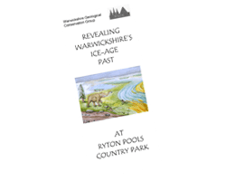
Revealing Warwickshire’s Ice Age Past
At Bubbenhall, quarrying has revealed important geological and archaeological finds. These provide evidence for major climate changes and human habitation during Warwickshire’s Ice age past.
A Rambler’s Guide to Building Stones in Warwickshire
This book is an enjoyable armchair read, and at the same time a practical field book. Its combination of practicality and good looks starts on the front cover with a new, stylish appearance and a title that could not be
more accurate. For this book belongs in the car pocket or the rucksack, always available when you are wandering in Warwickshire.
Show & Tell Warwickshire cards
7 information sheets covering Coventry, Kenilworth, Leamington, Nuneaton, Rugby, Stratford and Warwick. Each includes a detailed geological map of Warwickshire, a description of local rocks as well as details about fossils, buildings and industry in each area. Pdf format A6 size.

Last Updated on 04 Jan 2023
