12/09/2025 – Seahouses
Report by Tom Collins
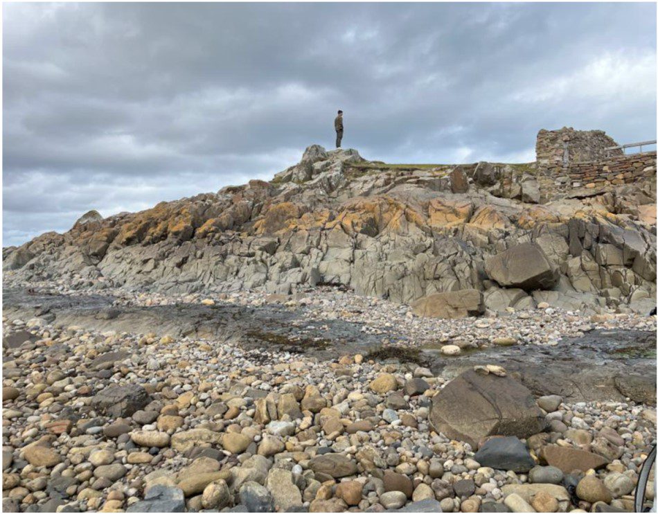
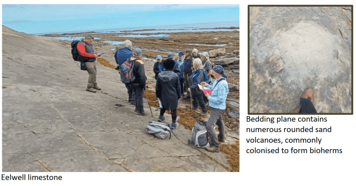
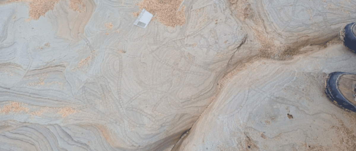
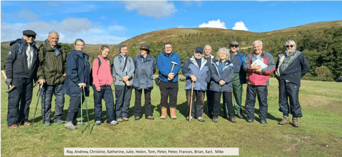
An eager group of sixteen assembled at Seahouses Golf Club, south of the town, for the first locality of the trip. Under the enthusiastic guidance of Karl Egeland-Eriksen and Brenda the group initially inspected the flooded remnants of a former limestone quarry within the Eelwell Limestone.
The thorough trip notes provided by Karl indicated that quarrying of the limestone for the lime industry dates from the 18th century, with the nearby harbour developing to support the quarrying and herring fishing industries. Lime kilns were recorded adjacent the harbour from 1768, with the terms of the lease agreement indicating the right to quarry local limestone and mine the local coal seams. Old maps of the area shown abundant now abandoned quarries and shafts in the area to the south of Seahouses.
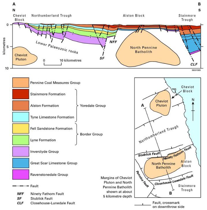
Following the Caledonian Orogeny and closure of the Iapetus (490 -390 Ma) a succession of
uplifted blocks and subsiding basins were created through crustal extension within the north of
England. The Eelwell Limestone was deposited within the Northumberland Basin, an ENE-WSW
aligned half graben. Infilling occurred from the late Devonian to the early Carboniferous. The
Eelwell belongs to the Yoredale Group of Lower Carboniferous age (upper Asbian (337.5 – 333 Ma)
(prev.Visean). The deposition displays cyclothem cyclicity resulting in sequences of limestone,
shale, sandstone, seatearth and coal being laid down. On average the limestone is approximately
8m thick. A subsequent period of compression associated with the Variscan Orogeny produced
numerous folds and faults as well as reactivating earlier faults, leading to variations in thickness
within the sequence. The Annstead Fault, striking E-W lies just to the south of Seahouses and
downthrows to the north by approximately 300m. The downthrow was calculated by Lebour a
Northumberland based geologist working for the Geological Survey in the 1870s and then teaching Geology at Durham University until 1918. This fault is responsible for a repetition of the beds at Seahouses also to the south at Red Brae in Beadnell. The Variscan events also formed an anticline with E-W axis at Seahouses which spans the town so that beds to the north dip in the opposite direction to that south of the town.
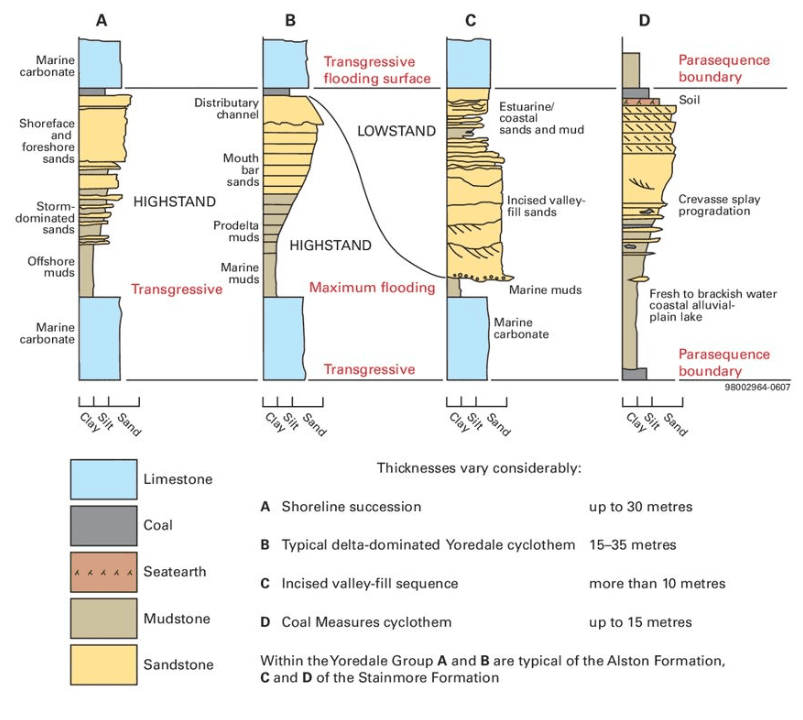
This cyclothem sequence is characterized repeated rhythmic fluctuations in sea level, moving from deep-water marine to shallow-water marine and terrestrial environments. The cyclothems begin with marine limestones, these limestones provide named marker horizons within the sequence, which progress through mud environments to sand environments and into terrestrial sands and sometimes thin coals before the sequence is repeated.
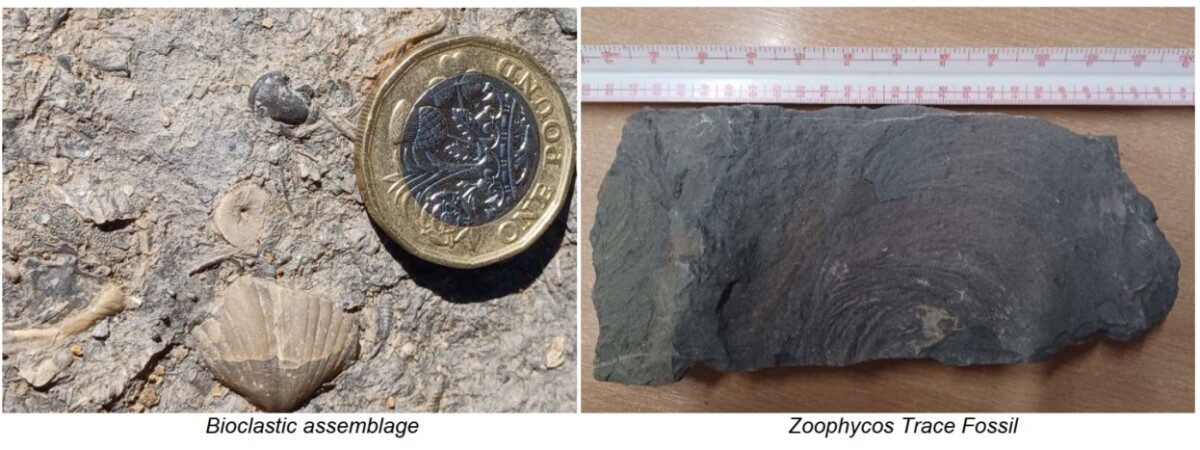
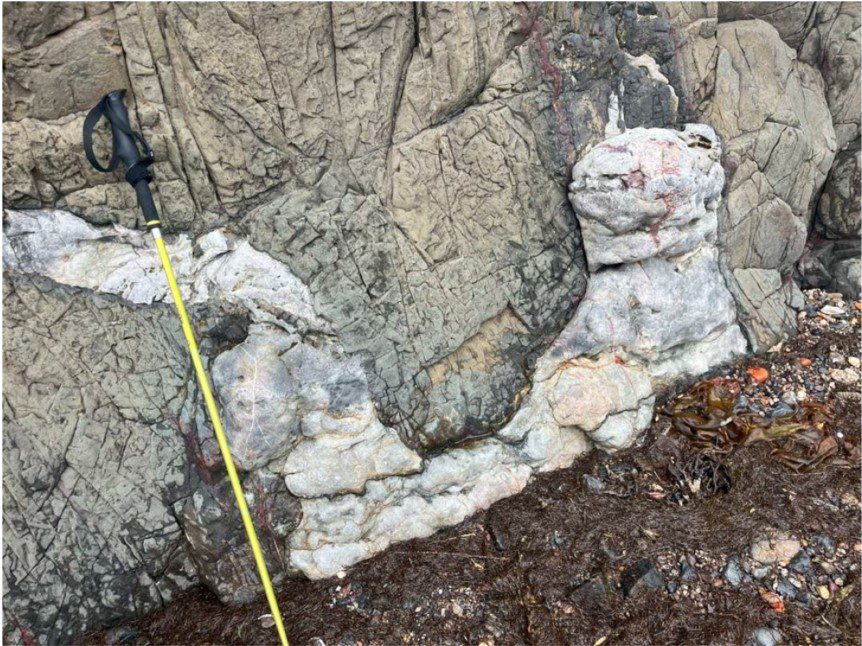
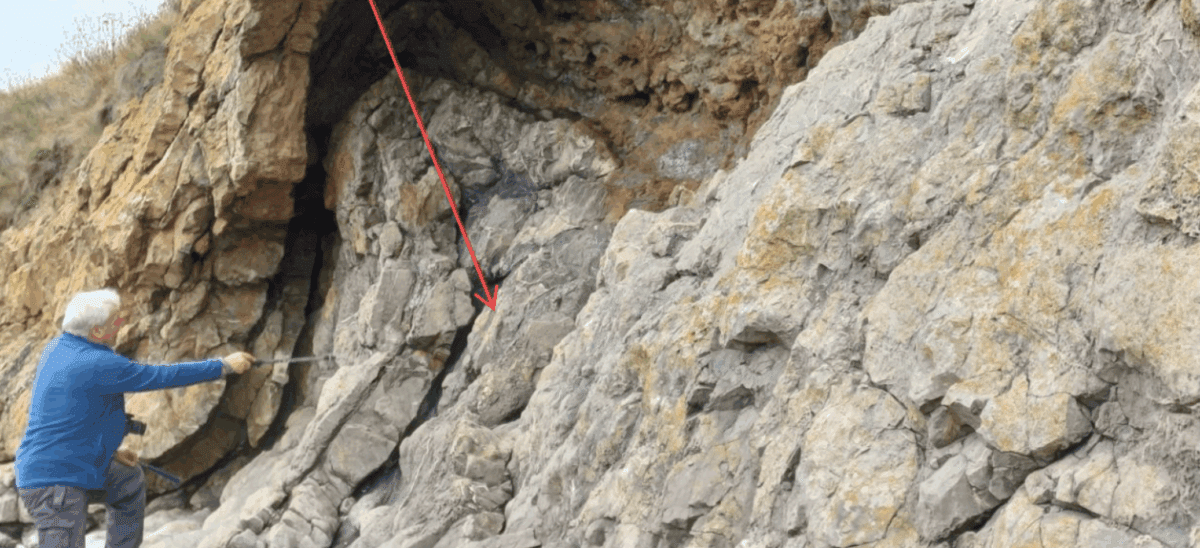
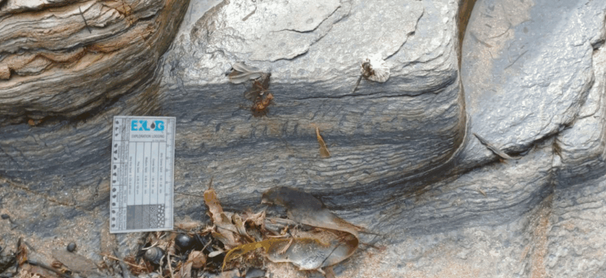
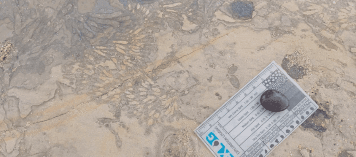
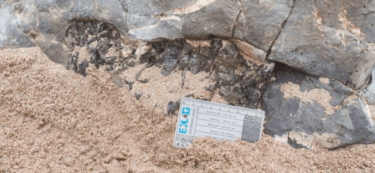
The first coastal exposure examined comprised Limestone representing the marine transgression/maximum flooding phase at the base of the cycle. The leaders explained and highlighted the particularly rich and distinctive marine fauna, reflecting its deposition in a clear, sunlit, tropical shelf sea environment. The Eelwell limestone member is the most fossiliferous limestone in north Northumberland with over 50 species identified. Fossils are primarily of small shells of Productus longispinus and Spirifer trigonalis along with larger ribbed shells of productid brachiopods, solitary and colonial rugose corals, crinoid ossicles and stem fragments, trilobites and Zoophycos trace fossils. A enjoyable ‘bioblitz’ style search was undertaken by the group.
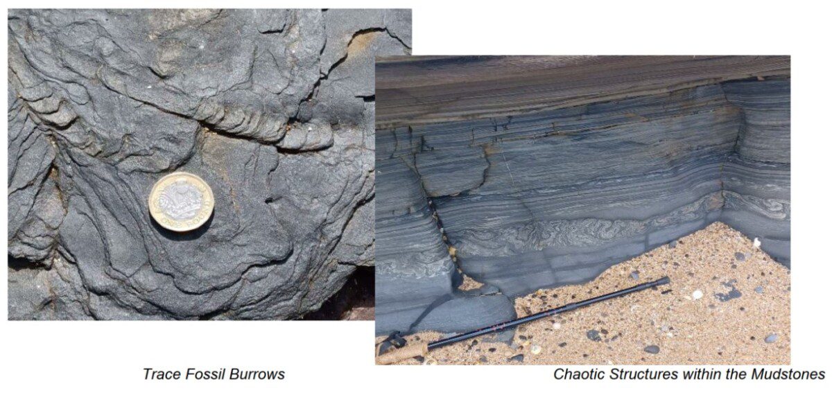
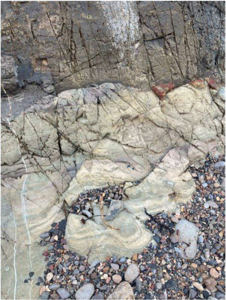
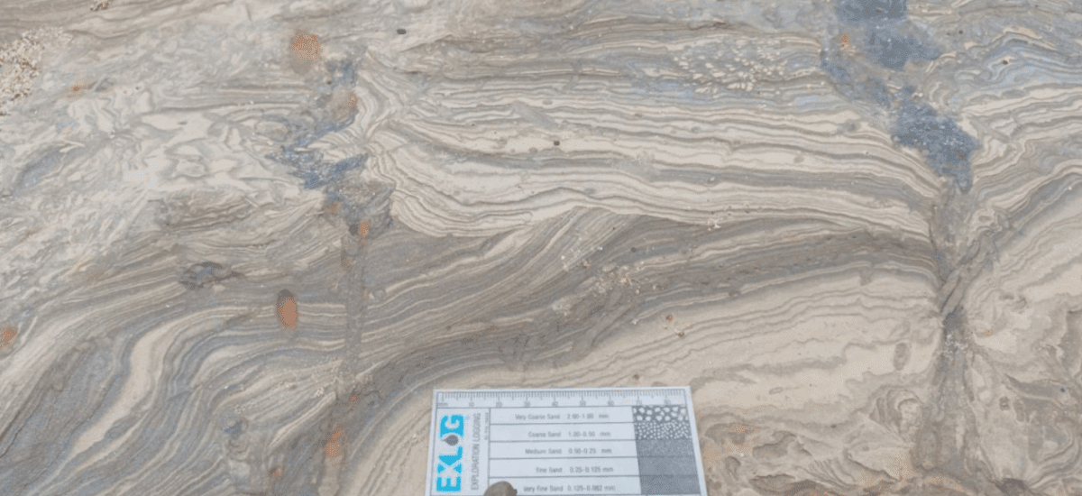
As the group moved northeast towards Snook Point, we moved through a sequence of progressively younger rocks overlying the Eelwell Limestone. initially transitioning to shaly mudstones with trace fossil burrows observed within the exposed surfaces. Possible dewatering structures and iron nodules were also observed and discussed. The mudstones represent a transition to a finer clastic marine environment.
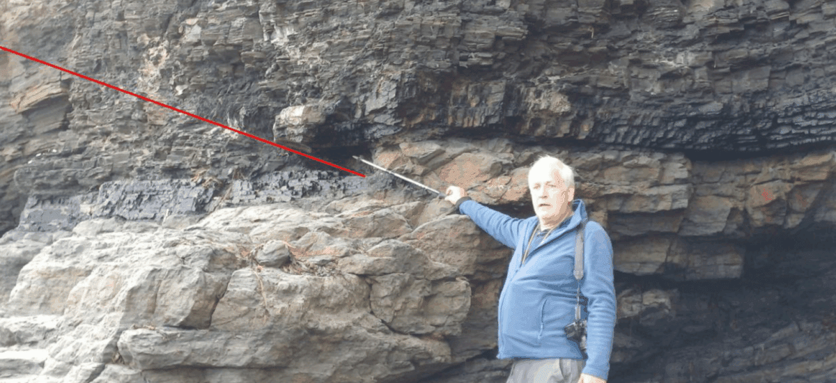
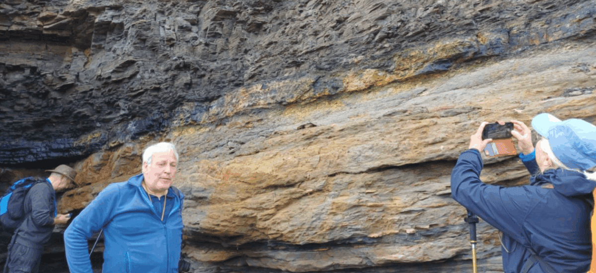
The next observed strata within the sequence comprised a coarser layer, signalling a marine regression (falling sea level) and the progradation of a river delta system over the former shelf area. The sandstone examined closely resembled Ganister comprising a hard, fine-grained, quartzose sandstone where the acidic water and plant roots from the overlying coals leached out easily weathered minerals (like feldspar), concentrating the resistant quartz. Silica, often derived from the dissolution within the soil profile, is then redeposited as a secondary cement between the quartz grains. This process creates a well cemented dense, highly resistant rock. Historically, the chemically inert, quartz-rich nature made these valuable as a refractory material (for lining furnaces). It was debated how true ganisters are derived from the seatearths and not the transgression sands.
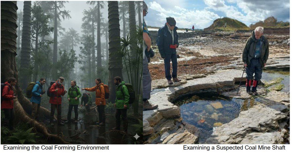
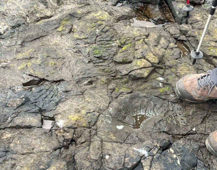
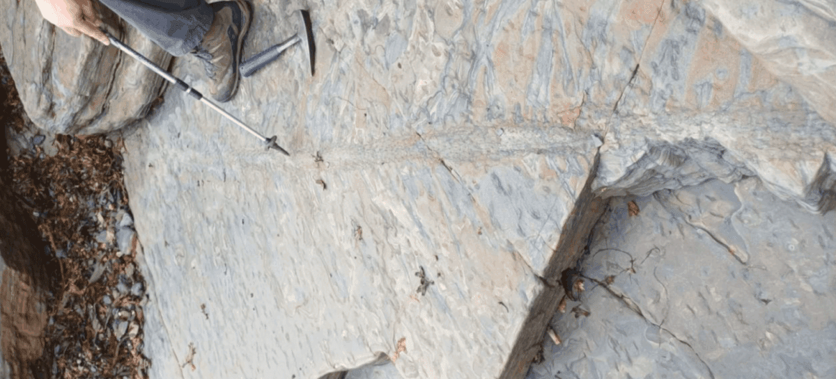
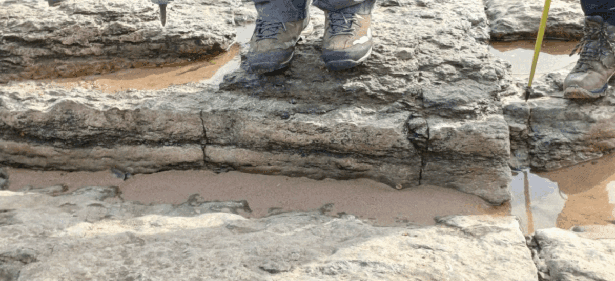
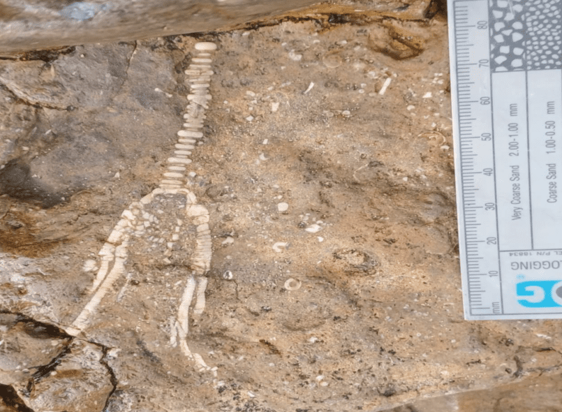
At the top of the sequence seatearth and Coal traces were observed representing a (Non marine/Lowstand). The top of the cycle, formed in a coastal swamp environment as the sea level reached its lowest point (lowstand). The seatearth derived from the underlying soil horizon, and the coal represent preserved swamp vegetation. Stigmaria fossils and fine coal traces, known locally as ‘Coal scares’ were observed in the seatearths and sandstones . The stigmaria were preserved as casts and moulds within the seatearth. Several examples were highlighted by the leaders which were of varying lengths and states of preservation. The casts form following the death of the tree, the main rooting structure rotting and sediment filled the resulting void, preserving the form of the root. Thin, pencil-like streaks were observed within the rock in one location adjacent to a larger stigmaria cast and it was debated amongst the group as to whether these may represent the traces of rootlets. The stigmaria represent a massive rhizomorph base which spread out horizontally, typically at shallow depths, from the base of the trunk of large clubmoss lycopods of up to 50m height. This base branched and was covered in spirally distributed circular scars. These scars marked where thousands of thin, highly branched rootlets attached. Because the Yoredale cyclothems represent rapid, repeated fluctuations between marine and terrestrial conditions, the swamp environments that formed the coal rarely had enough time to persist and accumulate very thick layers of plant matter. The coals in the Yoredale cycles are therefore commonly encountered as very thin bands or minor seams. Where historically worked in the Northumberland Basin the commercially exploited seams typically ranged from only 9 to 64 inches , with many being less than a metre. Upon retracing our steps back through the sequence, the remains of two suspected former mine shafts were inspected by the group with discussion about how the workings were protected from flooding from the tide.

13/09/2025 – Lindisfarne
Report by Rosemary Hyde
Lindisfarne is the largest of the islands off the Northumberland coast and connected to the mainland by a causeway covered twice a day by high tides. The tide times meant a more relaxed start to the day, as the official safe crossing time was set at 10.45am. However, we did manage to cross a little earlier – following behind the local ice cream van, who clearly knew the safe times to cross!!
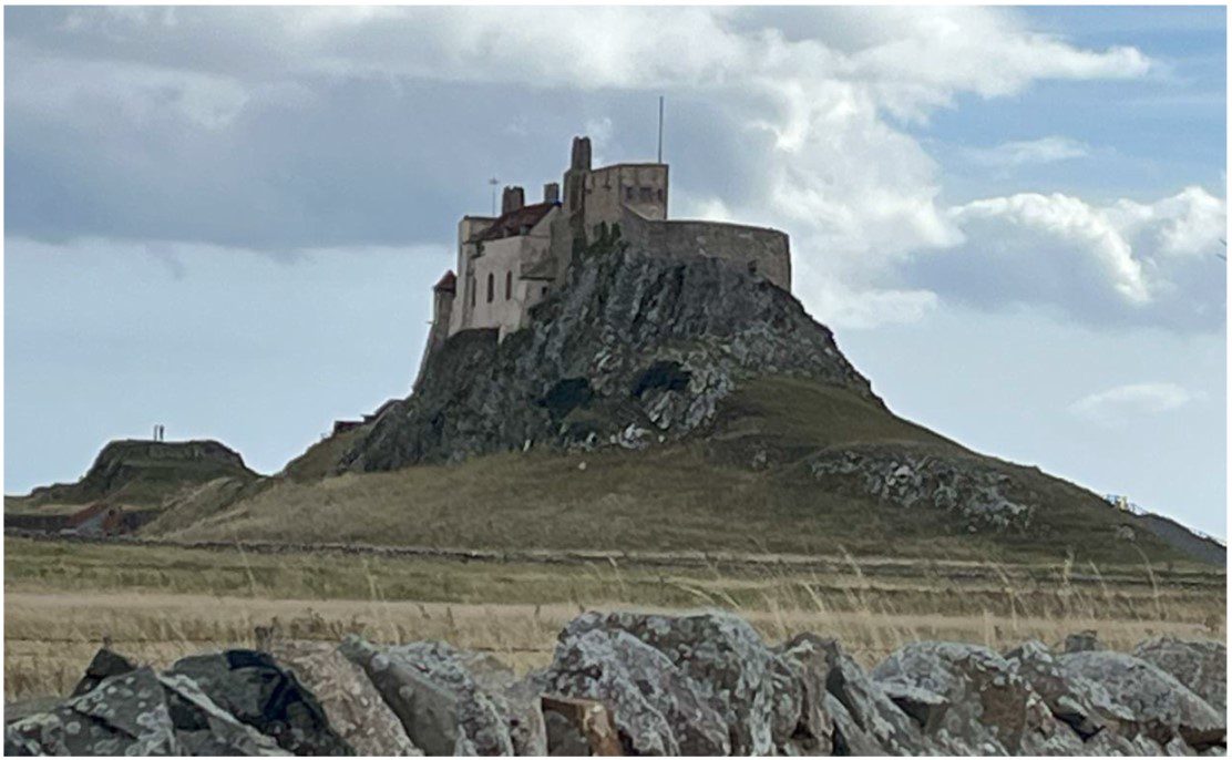
The majority of Lindisfarne is covered by superficial deposits, but there are rocky outcrops on the south, north and eastern shores, and the impressive Lindisfarne Castle is built on the Whin Sill dyke, formed during the Early Permian. The Winn Sill cuts through earlier outcrops of Carboniferous limestone. We started the day by heading through the village and out along the south beach to the area below the castle.
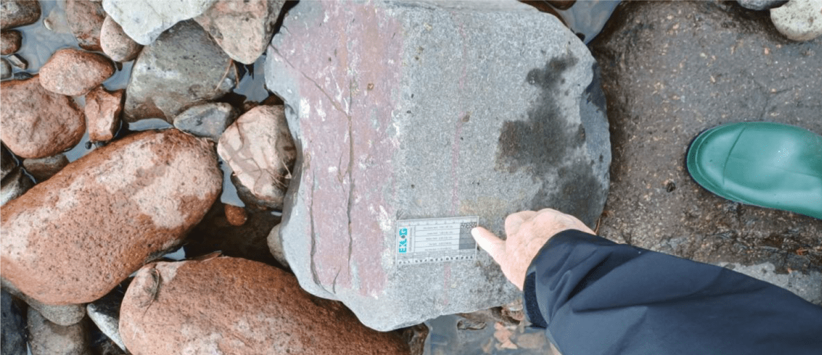
Along the shoreline of the South beach, running from Riding Stone to Cockle Stone, (NU133416-134416) we walked over outcrops of heavily jointed and baked sandstone, with several intrusions of the Winn Sill dyke visible, which follows an E-W trending fault. Further north along the shoreline, the jointed Sandbanks limestone was exposed, and below a small bench of rock, the discoloured chilled margin of the dyke could be seen. Near the top of the dolerite, gas vesicles were visible, where gases had become trapped in the cooling rock. In places darker inclusions were visible within the dolerite, indicating at least two stages of magmatic flow. It was Adam Sedgwick who first identified the magmatic rock of the area as a sill, and not a surface flow.
On the North end of the shore, below the castle, we saw the remains of six limekilns, (NU138417) where limestone (brought from Nessend quarry, to the NE of the island) was processed into lime, before being shipped to Scotland. In this Northern segment of the shoreline, the dark limestone was rich in bivalve fossils, as well as gastropods and crinoids.
adjacent to the dolerite
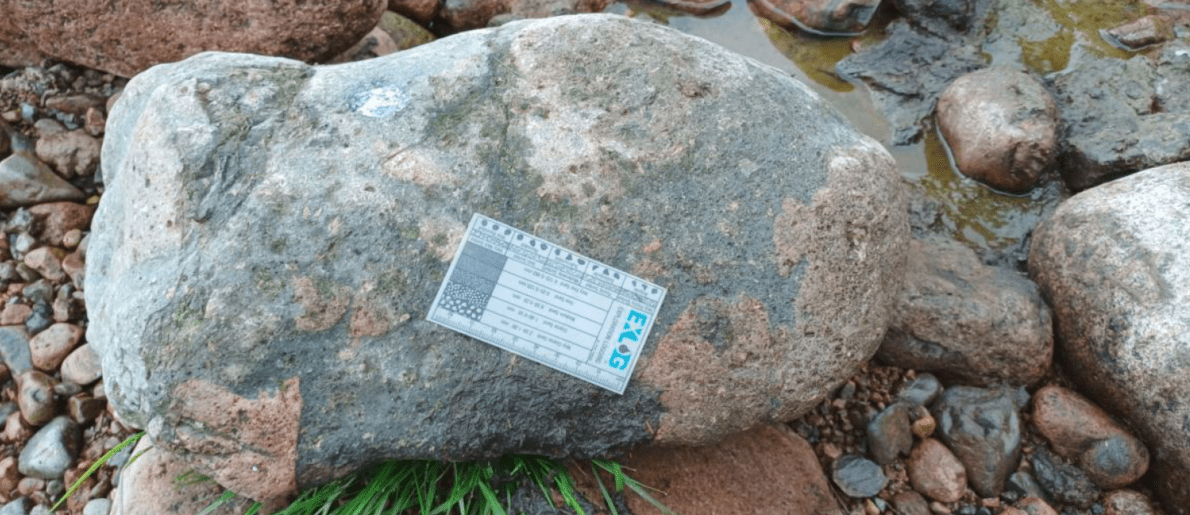
After a short stop for lunch, we met by the entrance to the priory, then examined the building stones of St Mary the Virgin church, including some distinctive cross bedded Carboniferous sandstones. We then headed over to St Cuthbert’s Island, off the SW of the island, accessible only at low tide. (NU123416). The island is composed entirely of quartz-dolerite outcrop, again part of the Winn Sill. The rocks were heavily jointed, giving a blocky pavement appearance, and on the surfaces we saw examples of “ropy flow”, flowing in various directions, and considered to have been formed in large gas vesicles when the magma as still moving. Elsewhere on the rocks were numerous flattened and elongated amygdales, 10-40mm in length, flattened parallel to the chilled surface and elongated with the direction of flow to the NNE. Observation of the rock on St Cuthbert’s Island indicated that there were three separate layers of dolerite, with three layers of vesicles, suggesting the possibility of three separate intrusive events. Vertical sections of the rock showed spherical amygdales throughout the rock.
By the time we had completed our examination of the rocks on St Cuthbert’s Island, the rain had truly set in for the day, with some members of the party being less prepared than others for the wet, cold conditions of the North East coast! Perhaps there was a little waning in the enthusiasm to examine rocks (and take notes) as self-preservation became an important focus!
Clad in all our waterproof layers we moved back onto Lindisfarne to examine the cliffs just
north of the old Lifeboat house, near Tripping Chare. (NU123419) at the SW end of the island. Here glacial till rests on finely laminated sandy shale. At the base of the till, above the undisturbed shale beds were rocky sandstone fragments, which are “ground moraine”, transported and deposited by ice in the last Ice Age. In places along the cliff, the top shale layers were disturbed where a small thrust had occurred, but most of the lower shale layers were completely undisturbed.
Our next stop was at Heugh Hill, East of St Cuthbert’s, and South of the Priory. (NU125416 NU127416). This is the longest section of the Winn Sill, and there are good exposures on the southern margin showing contact between the dyke and the Carboniferous country rock.
The country rock was noticeably darker close to the dyke intrusion, indicating metamorphic processes (high temperatures) causing the baking and change of texture in the limestone.
Nearer the foreshore, to the east of Heugh Hill (NU127416), the Acre limestone is exposed and is quite fossiliferous. We spotted productid brachiopods, gastropods, crinoids, and orthoconic nautiloids.
We finished the day at Steel End, at the Eastern end of Haugh Hill quartz-dolerite section (NU129416), where the rock dips gently eastwards, and is exposed at low tide. Here we observed, amidst the seaweed, numerous elongate amygdales and “ropy flow” structures, similar to those seen in the morning on the dyke section below the castle. As we walked back to the cars after a very informative and enjoyable day, the rain stopped, enabling us to dry off a little before our drives back over the causeway to our accommodation for the night. We all made it back in plenty of time before the high tides cut off Lindisfarne again from the mainland.
14/09/2025 – Cocklawburn Beach
Report by Ray Pratt
On days 1 and 2 exposures to the south were generally low angle dipping beds of the same units, with dolerite Whinn sill intrusions either bed parallel of cutting through the beds as dykes. The whin sill does not extend further north than Holy Island. On day 3 the northerly exposure could be seen to have been subject to greater tectonic stresses resulting in a compression zone known as the Berwick Monocline.
Saltpan Rocks marks the most northerly exposure of the Eelwell Limestone in Northumberland (10). It develops small folds and minor associated thrusts throughout its foreshore outcrop.
The Eelwell Limestone, 8m thick, contains a prominent fauna of large Gigantoproductus and corals, develops small folds and minor associated thrusts throughout its foreshore outcrop. The limestone is locally dolomitized, brown weathering and vuggy.
southern part of the Berwick monocline in the distance
Just south of Seahouse, it is involved in a sharp overfold facing west, which further south is thrust through its short limb. On the top surface of the gentle, whaleback folds to the east and south, polished sections through the rich fauna of spiriferid brachiopods at the very top of this limestone can be seen.
Out on the foreshore here, the 30cm Acre coal (11) occurs beneath sandstones showing medium to large scale lenticular cross-bedded sets. Where the coal crops out in the cliff at the back of the foreshore, it is involved in a small thrust with a 1m vertical displacement. Just above are excellent examples of climbing ripples and a rootlet bed.
beneath the coal
The 4.5m Acre Limestone, also developing minor folds on the foreshore, has a very thin, impersistent sulphurous coal beneath it. The limestone, crinoidal, with scattered fossils and small algal nodules, is brown weathering, dolomitized and vuggy in places.
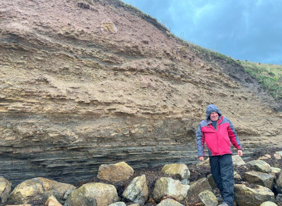
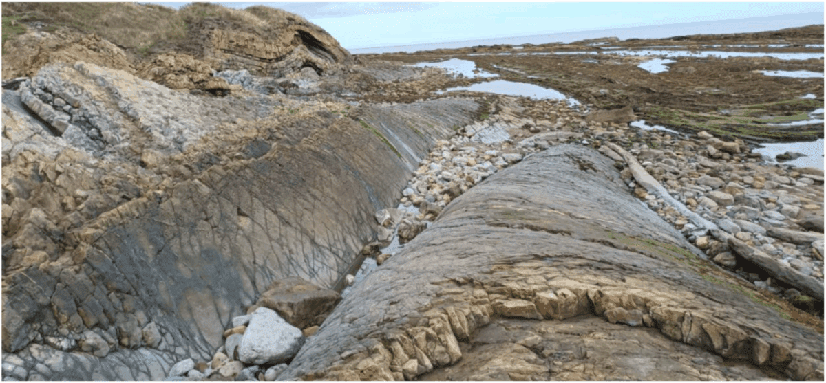
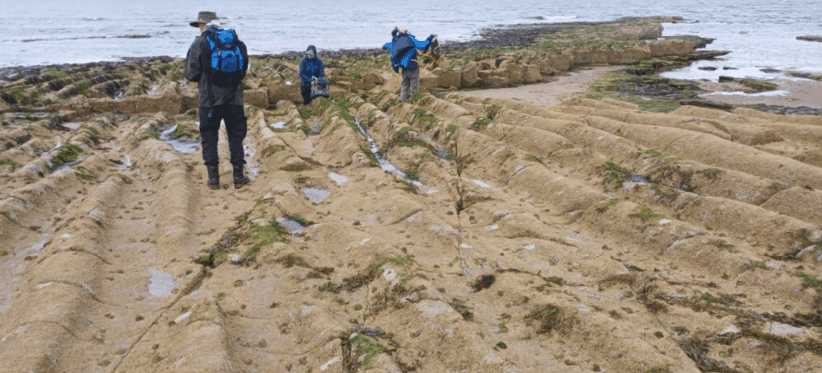
Following lunch we walked southwards along the beach until we came to the exposures known as the Skerrs. This outcrop is formed of 8.5m known as the Sandbanks Limestone, a series of thin limestones with shale partings. These beds showed gentle anticlinal and synclinal folding, in contrast to the severe folding seen at the northern side of the beach.
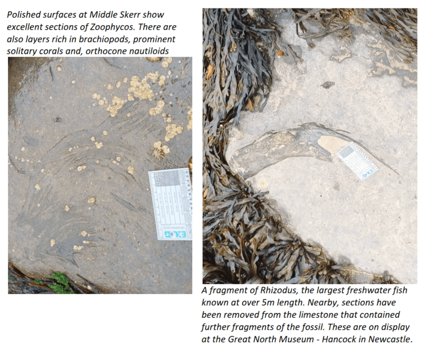
How fragments of a freshwater fish end up in a marine limestone has been a topic of debate, as has the unusual ripples to be seen in the same bed close to low water. It has been proposed that a storm event was the cause of both, bringing the dead freshwater fish into a marine environment and creating these large ripple beds.
Extensive bioturbation was evident in the argillaceous silty deltaic deposits.
was also seen in a nearby bedding plane
15/09/2025 – Brough Law, Breamish Valley, Cheviot Hills
Report by Ray Pratt
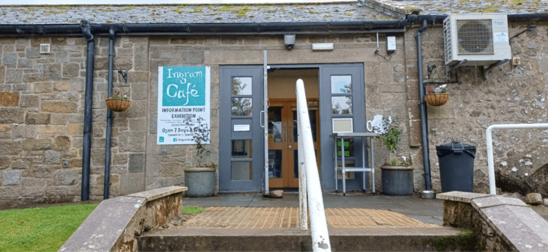
We gathered for the final day just past Ingram, expecting foul weather. Thankfully, the rains stayed away and blue skies dominated until we had finished the trip and were relaxing in the cafe at Ingram enjoying delicious home baked cakes and scones. Unfortunately, the streams were swollen from earlier rains in the month making some of the exposures that we had hoped to visit, inaccessible.
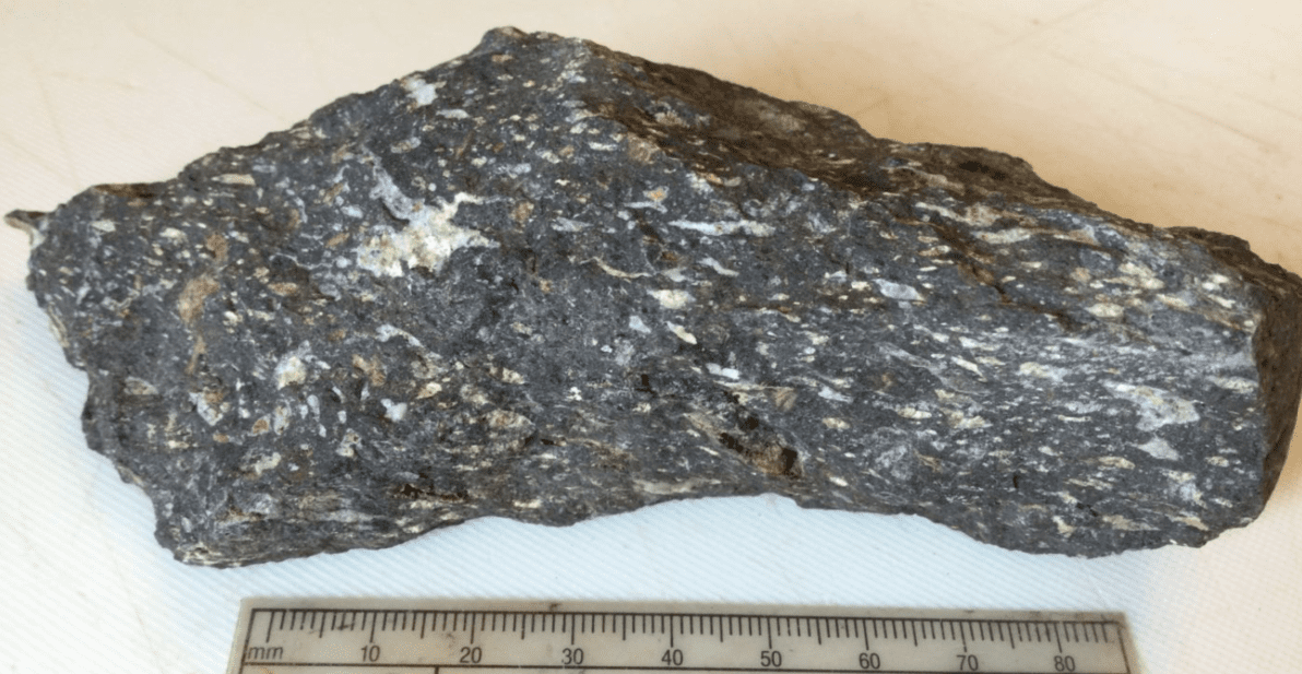
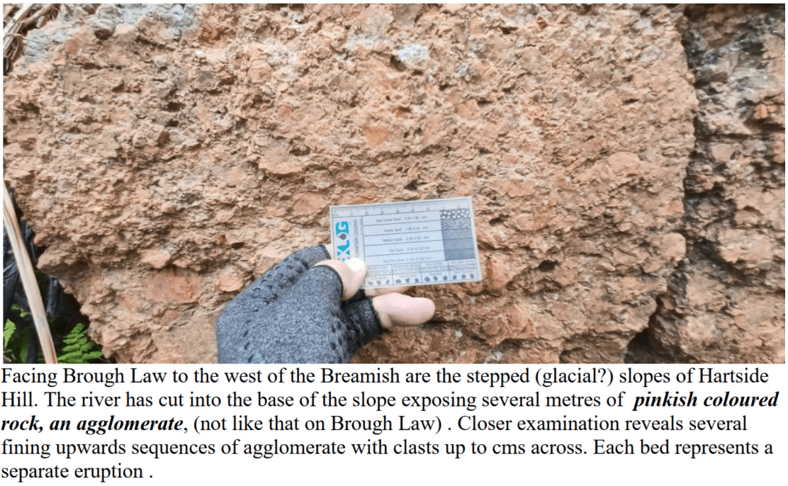
The geology of the area is dominated by Devonian volcanics. Early sub-aerial volcanism was explosive forming basal agglomerates with clasts up to 1.5m in size. The agglomerate is a silicified breccia containing primarily fine-grained purple mica-felsite (rhyolite) with some fragments of Silurian rock. Later volcanism was predominantly effusive with occasional ash showers. The earliest lava flows were rhyolites (mainly mica-felsites) and are generally brick-red to red purple in colour and rich in biotite. These were succeeded by pyroxene-andesites which make up the bulk of the Cheviot volcanics. They include glassy andesites, oligoclase trachytes and augite hypersthene andesites and range in colour including red, brown, purple, grey and almost black. Mainly medium to coarse grained, they are compact and well jointed. Phenocrysts are usually plagioclase feldspar but may include mica, augite and hypersthene. Some of the andesites are vesicular and amygdaloidal. Thin beds of ash are common. Volcanism was followed by intrusion of the Cheviot Granite which now constitutes most of the central area with a few preserved fragments of lava. The granite has a varied composition possibly indicating more than one injection of magma. Varieties include marginal (dark grey, fine to medium grained), granophyric (pink, medium to coarse grained) and Standrop (light grey, medium to coarse grained). The final stage of Devonian igneous activity was the intrusion of dykes. They have a general trend of either NNW or NNE.
Unfortunately exposures of bare rock are limited, many being covered either with bracken and gorse or scree. Fortunately, a lot of these lithologies can be found as boulders in the shallow river by the car park. As the Cheviots had their own ice cap during the glaciations, only Cheviot rocks are found in the streams. Ice sheets carrying rocks from other sources were deflected away from the Cheviots.
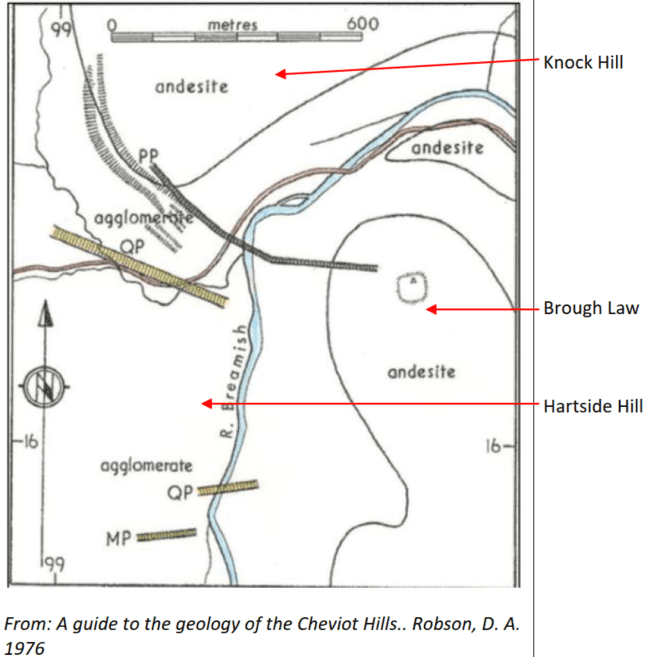
The hill known as Brough Law is composed of agglomerate/tuff at the base, capped by andesite. However, this interpretation is too simplistic as exposures of andesite, with flow banding in places, seem to be abundant and higher up reportedly, lapilli-tuff seems to dominate with fewer outcrops of andesite.
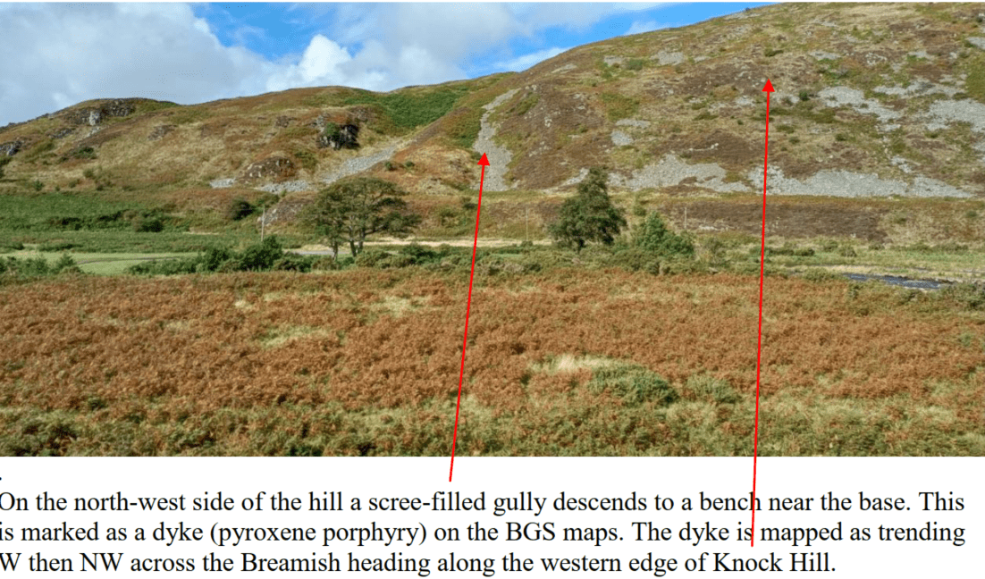
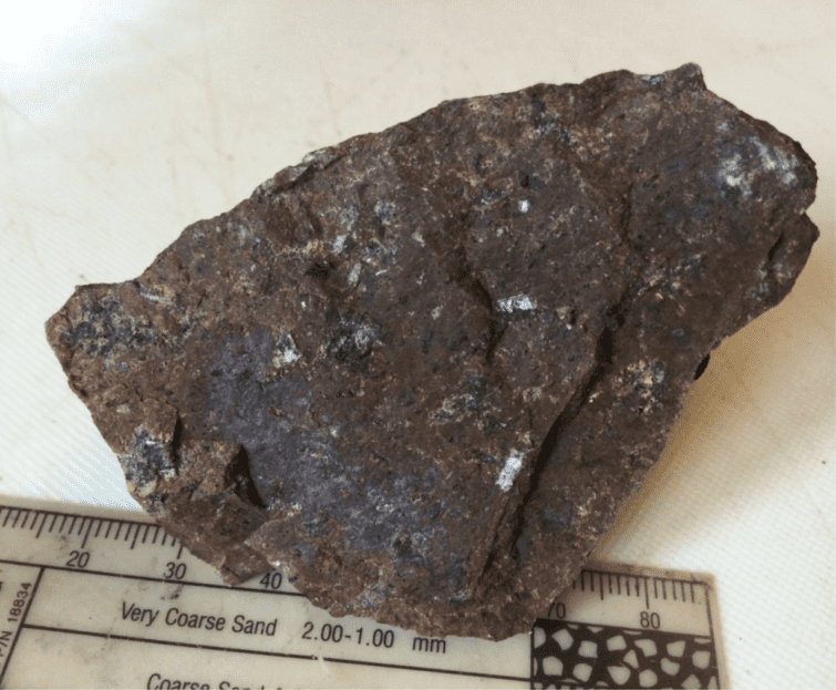
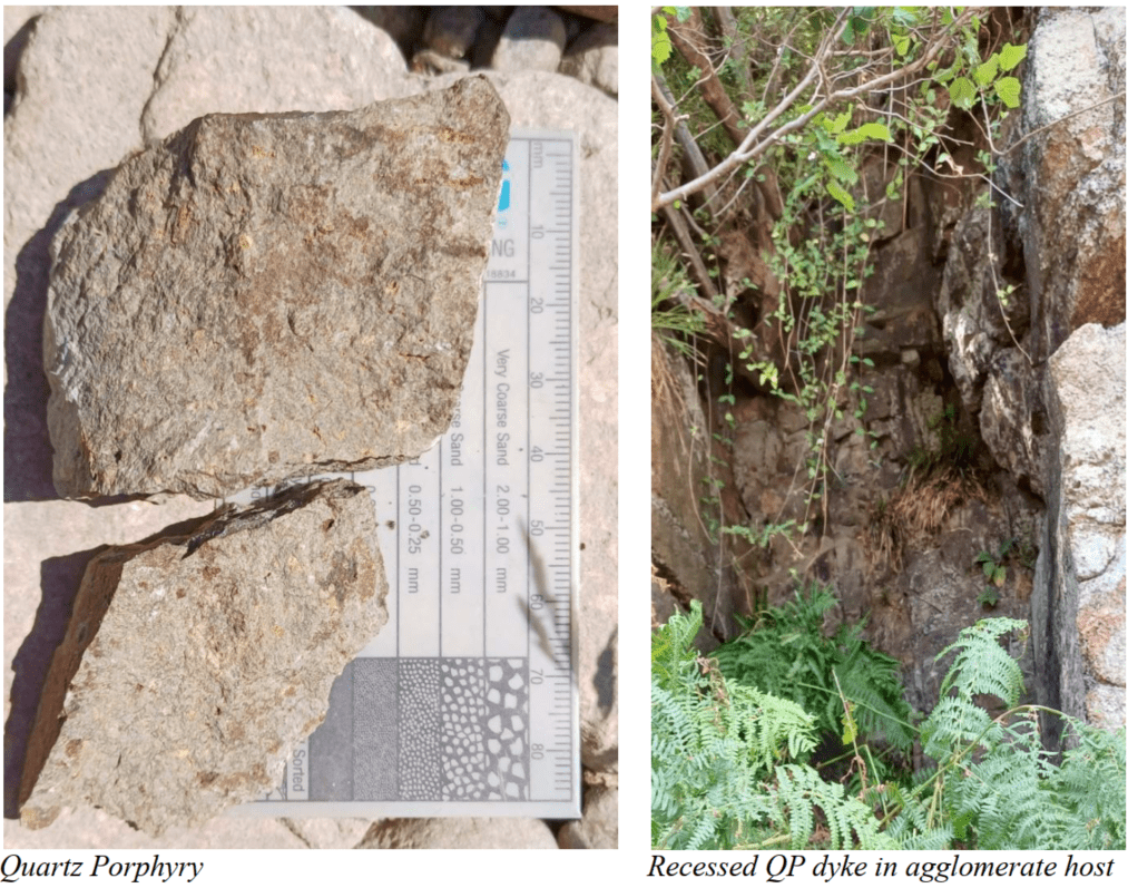
A 2m wide slot just above the river marks the position of an E-W trending dyke (quartz porphyry). It is a dark grey rock unlike most of the other late Cheviot dykes which tend to be red.
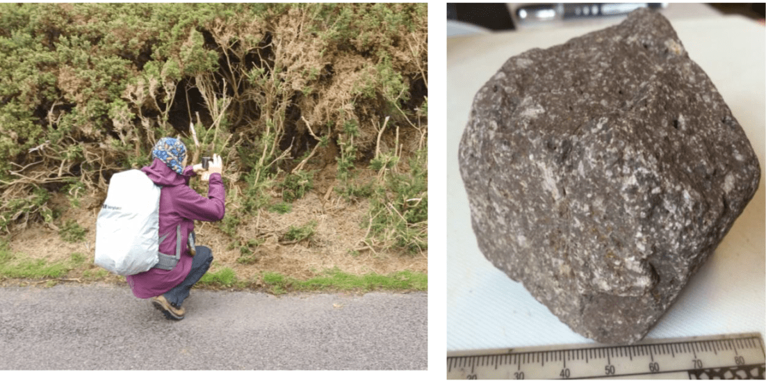
Along the roadside to the south-west of Knock Hill another quartz porphyry dyke outcrops. This trends south-eastwards towards Brough Law. Unlike the quartz porphyry dyke on Hartside Hill, this one is red but now overgrown by gorse.