
Report by Ray Pratt & Jane Allum. Attendance 11
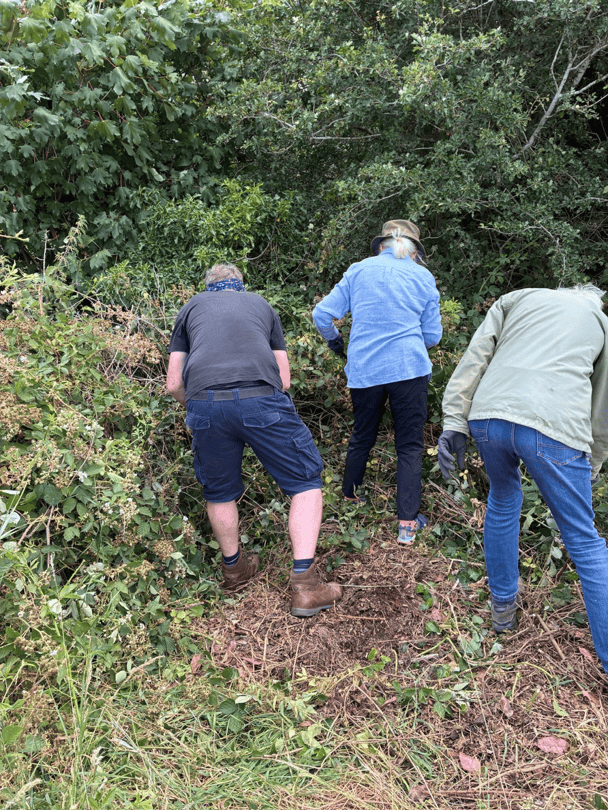
On Saturday, July 4th, a small team of WGCG members undertook a clearance session at the quarry in preparation for this visit led by Stuart Burley.
Many thanks to Gareth Jenkins, Ray Pratt, Nigel Prentice and Rosemary Hydye. Gareth, Rosemary and Nigel seen here cutting their way into the quarry which was densely overgrown with stinging nettles. There was also much algae growth over the rock faces since last jet washed by WGCG.
Castle Quarry is one of the few exposures remaining in the Kenilworth Sandstone and was excavated in the upper part of the Kenilworth Sandstone Formation, very close to the western boundary fault of the Coventry Horst. There are three exposed faces in the quarry which we estimate provide a total exposure of around 7m of stratigraphic section.
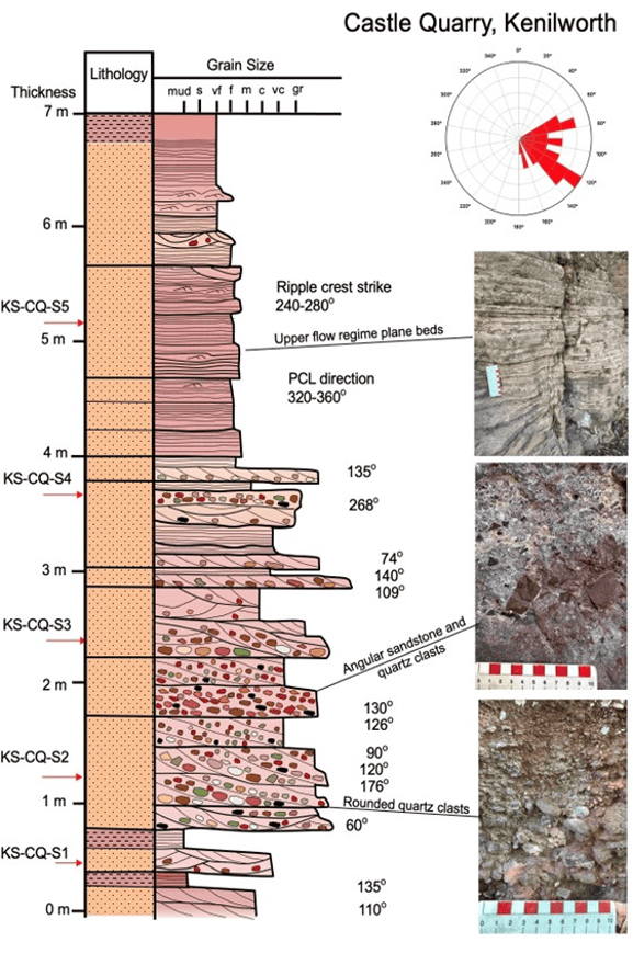
On entering the quarry at the western end, we encountered a planar bedded unit, a sequence of high energy, upper-flow regime, plane-bedded sandstones. Close examination of these reveals some low amplitude ripples and bedding surfaces show parting current lineation, typical of upper flow regime plane beds. The absence of a fining-up sequence terminated by a mud unit indicates that these are not low energy over-bank deposits. These were probably laid down as shallow water flash flood events in a broad river valley.
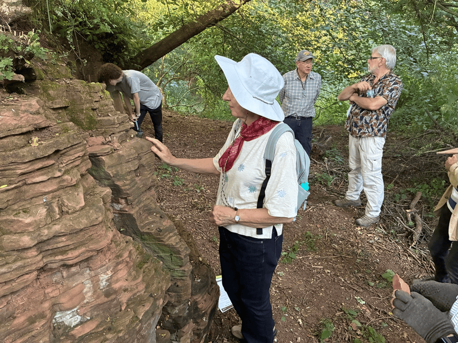
As seen above the plane beds are c.200mm thick comprising slightly silty fine to medium subangular to rounded sandstones. Sub-horizontal faulting and joints were also noted.
Following the trail around to the eastern side of the quarry, we find the underlying breccio-conglomerates. Pebbles in the conglomerates are of distinctive rock types and indicate source provenance. The conglomerates are hard. The matrix of the conglomerate was medium to coarse sandstone. In parts the conglomerates are cemented together by secondary calcite cement.
The photograph below was taken last year following the jet washing of the rock face and shows the poorly sorted nature of the conglomerate comprising subrounded sandstones, mudstones and quartzite pebbles noted in the sand matrix. Calcite veins were occasionally noted in the mudstone clasts. The orientation of foresets on the cross-bedding indicates that the paleocurrent for these breccio-conglomerates was predominantly to the southeast (see the Rose diagram in the graphic log section).
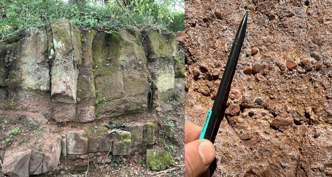
This exposure, along with many others in the district, was mapped in detail by Fred Shotton in 1929. He classified this as a breccia, in contrast to the Gibbet Hill exposure which he classed as a conglomerate.
The Kenilworth Sandstone Formation has been considered to be Permian in age based on the discovery of three partial skeletons of the amphibian Dasyceps, the first of which was found in 1849.

Stuart proposed that the evidence for this is scant as the above fossil is also attributed to the late Carboniferous. If this is the case these deposits may equally be a continuation of the late Carboniferous Warwickshire Group, as the boundaries between the underlying Tile House Mudstone Formation and the overlying Ashow Formation are all conformable, with a similar depositional setting throughout. The basin in which they were all deposited, initially called the Coventry Cuvette, stretches as far south as Oxford. The Kenilworth sandstone is only seen in the Kenilworth area as elsewhere it has been eroded.
The western Boundary fault reportedly runs north south, literally at the western end of the quarry. There is no evidence of this within the quarry.
Published reconstructions of Kenilworth Sandstone palaeogeography provide another conundrum. Sediment supply is reportedly from the Variscan Front mountain range to the south, but mapped flow direction from these outcrops suggest a westerly source.
Clearly there is a lot to consider in determining the history and age of these beds. Thanks to HS2 Stuart has been able to log most of the new cuttings along the path of the new rail line, recoding data that has never been seen before, and in many cases will never be seen again.