Report and photos (unless otherwise credited) by Ray Pratt
The purpose for this weekend trip, apart from having a great social time in a lovely part of the UK, was to explore the upper Palaeozoic rocks of South Shropshire. A year earlier Martin Whiteley led a WGCG group to look at the Lower Palaeozoic rocks of the county. Martin, a retired professional geologist, is well known to members of WGCG, having led a number of excellent trips for us in the past. He is known, not only for his excellent communication skills but for also managing to organise good weather – a rare talent. He also seems to be well known by many local residents who he has met on his reconnaissance visits, persuading them to allow us to enter their property to view the exposures on their land, also giving us parking permission to boot.
The Friday afternoon was spent walking around the historic town of Ludlow taking in the variety of building stones used in the town, particularly those sourced locally. This was a useful exercise as exposures of some of these rocks are no longer available. Saturday focused of the change from marine to continental deposition around the Silurian- Devonian boundary and the overlying Carboniferous rocks. The day concluded by looking at the late Carboniferous igneous activity on Clee Hill. Sunday was mostly spent examining the evidence for desert conditions that persisted in the early Permian, concluding with a walk to examine the overlying Triassic fluvial deposits.
Friday: Ludlow Building Stones Tour
For those able to meet up early Friday afternoon, Martin led a walk around the centre of Ludlow pointing out the building stones used to adorn the town buildings, many of which were locally derived.
Saturday: Silurian, Devonian and Carboniferous Successions
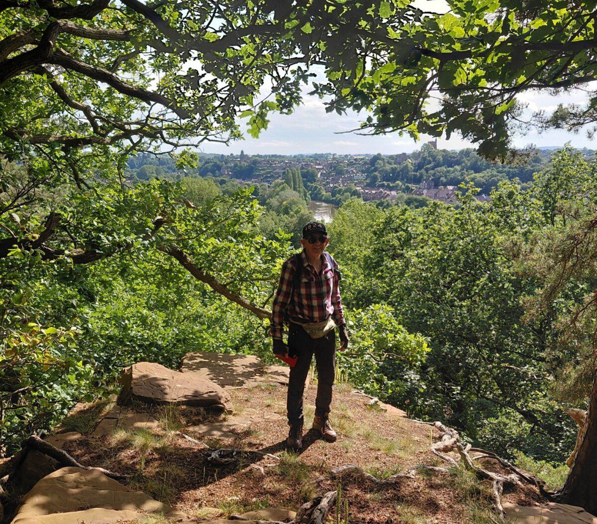
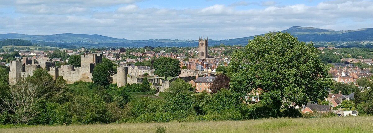
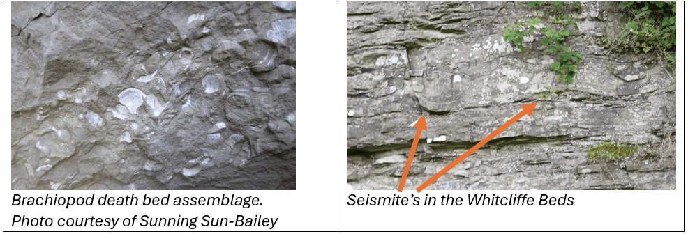
Meeting up at a parking layby by Whitcliffe Common, on the west side of the Teme river, we were offered a spectacular vista of the town of Ludlow down in the valley and the Titterstone & Clee Hills on the horizon to the north-east (see photo above). Following a footpath over the common, we made our way down over the tree clad slope to Whitcliffe Quarry, a SSSI locality. Here we saw a thinly bedded sequence of well bedded yellowish grey calcareous siltstones with some thin limestones, dipping ENE at c.5°. The lime content can vary. Occasionally the beds are thick as a consequence of bioturbation
Brachiopod fossils were common, as were trace fossils (burrows) and occasional gastropods. These beds were laid down c.420Ma during the Ludfordian stage of the Silurian, in a shallow water marine environment located c.20° south of the equator. Overall, this was a quiet shelf setting, however, occasionally we see undulations in the beds. These are attributed to tectonic instability whilst the sediments were unconsolidated and are duly called “seismites”.
Two further exposures of the Whitcliffe Formation beds were seen in cliff faces as we made our way eastwards to Ludford Corner, the historically important type locality for the Ludlow Bone Bed.
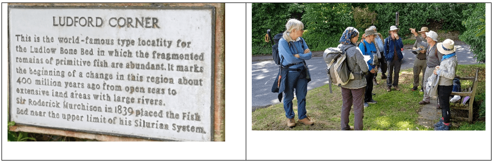
This exposure is overgrown, and deliberately kept that way. The actual bone beds are only in total 10cm thick and have been so collected by enthusiasts that they are now in a crevice of arm’s length depth. Initially thought to be the boundary between the marine Silurian deposits and the overlying Devonian continental deposits, these beds are now placed at the base of the Downton Castle Sandstone Formation at the base of the Silurian Pridoli Epoch. The Ludlow bone beds are widely classified as a marine nearshore (littoral) lag deposit. They formed as the shallow, warm Silurian seas retreated. As the environment shifted, remnants of marine creatures, freshwater organisms, and terrestrial debris were washed together and concentrated by storms or intertidal currents. Because of this unique depositional setting, the bone beds contain a mix of different fossil types:
- Marine fossils: Brachiopods, ostracods, and marine fish scales.
- Terrestrial & freshwater fossils: Early primitive fish, spores, and charcoal.
Exposures of the Downton Castle Sandstone (above the bone beds) were examined a few yards around the corner.
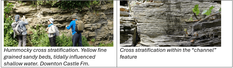
Here we see intertidal fine grained sandstone deposits in the form of hummocky bed forms. These cross laminated beds show opposing directions of movement that is typical within a shallow water tidal zone. These deposits are small and localised, tidal sands.
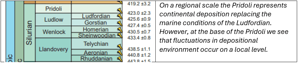
In the 6-7m of deposits above the Ludlow Bone Beds we see evidence of fluctuating sea levels as the overall trend goes from a marine to a terrestrial depositional setting.
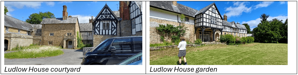
Whilst we were examining the exposure of Downton Sandstone forming part of the foundations of Ludlow House, the owners came out and invited us all in, telling us of their restoration plans for the buildings.
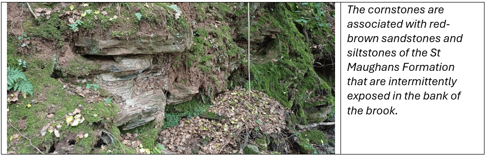
Returning to the cars we headed off to Benson’s Brook to examine the St Maughans Formation. Fragments of Lower Devonian cornstone are found as loose blocks in an area that has been extensively quarried. The cornstones or calcretes were extracted for their lime content leaving only a few boulders that we see today. These continental “limestones” have been formed by the secondary enrichment and crystallisation of calcium carbonate in soils due to osmosis in a hot tropical environment. Fortunately, we were able to see an equivalent section in situ the following day at The Leath near Ditton Priors.
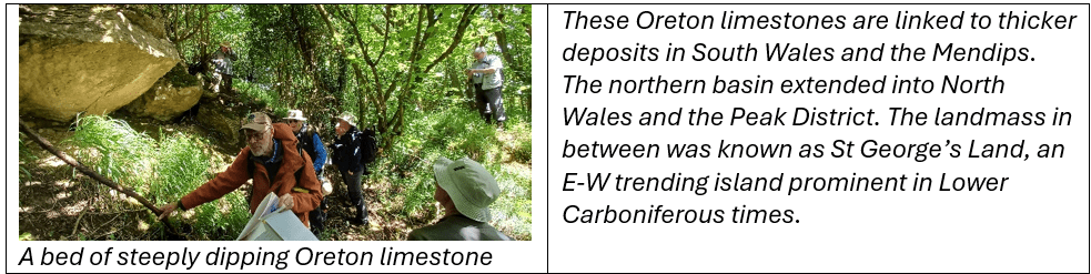
In Shropshire there are no deposits of middle Devonian age, probably as a result of localised uplift. There are some late Devonian alluvial sediments (not seen on this trip), which are overlain by the Carboniferous marine Oreton Limestone. Given the deposits are not widespread in Shropshire it is likely that a coastline existed close by during deposition.
Hidden away within the trees at Gorstley Rough, we were guided to a small exposure of Tournaisian Oreton limestone, part of a 20m thick deposit on the flanks of the Clee Hills. The deposits here are rather sandy and occasionally oolitic, both of which indicate a shallow water environment. Ten kilometres to the north there are more Carboniferous limestones, similar to the Oreton Limestone, but they formed in a separate basin on the other side of the Clee Hill high.
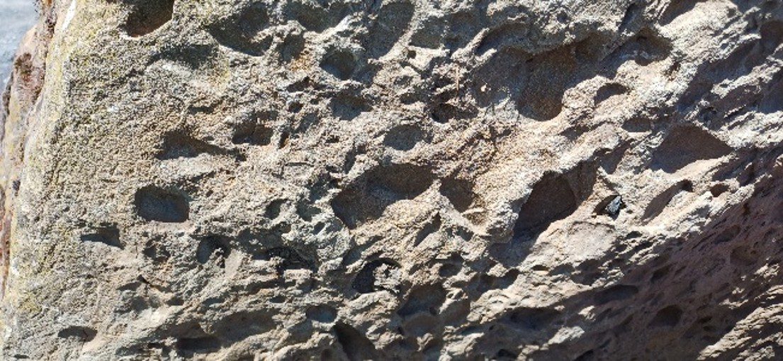
At the Cleehill viewpoint, a number of Carboniferous Cornbrook sandstone blocks were used to demarcate the sitting area from the parking area. These are coarse feldspathic sandstones, deposited in a high energy fluvial system. The hollows that pit the surface are reportedly where clasts of mudstone were located. These rocks were probably laid down during Carboniferous Westphalian times. We did not get to see these rocks in outcrop.
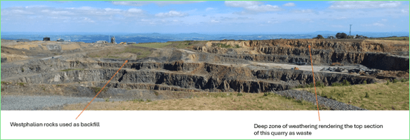
Our next stop was Incline Quarry viewpoint on Clee Hill. Quarrying of the dolerite for stone production and the manufacture of pavement setts, started here in the 1850s. The dolerite sill was intruded into Westphalian Coal Measure deposits during the Hercynian. It extends down to about 5m below the water level and is up to 60m in thickness. It exhibits columnar jointing. The rock is locally known as dhustone, dhu being Welsh for black.
The country rocks are reportedly baked by the margins of the sill. There are also some “tongues” of the sill that protrude into the overlying country rock. The feeder vent has not been identified. The sill has been radiometrically dated at c.300Ma, slightly younger than the Westphalian sediments into which it intrudes.
Moving north over the hill to the far end of Clee Hill Quarry we were able to view another section of the sill. It used to be overlain by 30m of Coal Measures, but these were removed between 1988-1992 to exploit the associated coals. Parts of the sill have been subjected to deep weathering (of Tertiary age?), whilst elsewhere it remains fresh and is still quarried as hard rock for sea defences, gabions and ballast.
Sunday: Permian Deserts
(A more detailed report of the Bridgnorth area will be posted following the WGCG trip in July)
On our way to Bridgnorth we stopped at The Leath near Ditton Priors to examine an unworked section of the St Maughans Formation. This exposure is on private property off a tight windy country lane. Martin had managed to get the property owners permission not only to visit this exposure but to also park our fleet of cars on his driveway. Here we were able to examine the silty paleo-soils that had become calcified (calcretes) during tropical conditions in early Devonian times
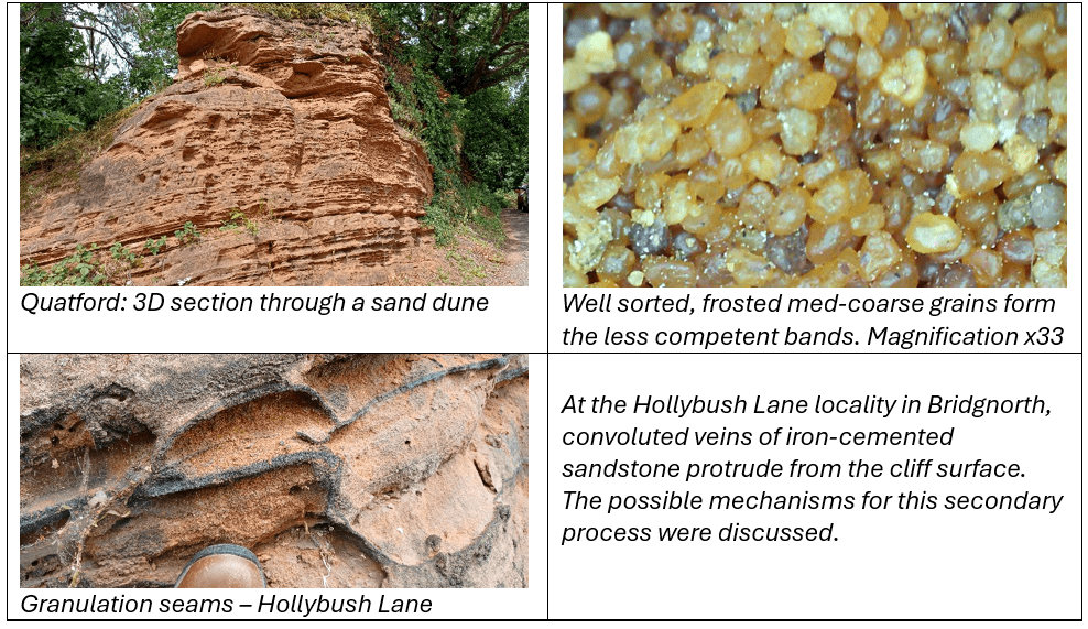
From here we proceeded onto Quatford, just to the south of Bridgnorth, before heading into Bridgnorth itself. At both locations we observed large scale features characteristic of sand dune deposits. Getting close up we examined the fine scale variations within the succession and observed the classic aeolian sorting and shaping of the grains. Discussion focussed on why these sandstones are red when in modern day deserts they are yellow. The sands are coated with a very thin layer of haematite but its origin is unknown.
Both transverse and barchan dunes are observed in all the locations visited. The prevailing winds at the time have been established by careful analysis of bedform geometries as coming from the east and northeast, (which is the same as the trade winds today in the Sahara). Measurements in barchan dunes will generate a lot more scatter of orientation by the very nature of their geometry.
A more detailed discussion of these desert deposits is given in a dedicated article in this newsletter following a WGCG day visit to Bridgnorth with Stuart Burley, where many of the same localities were visited.
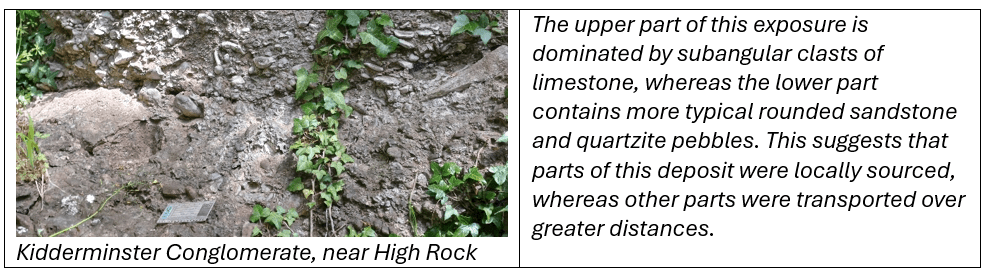
To end the day, we took a hike from the town centre past the beautifully maintained cemetery with its Alpine inspired chapel, along a narrow woodland track up to the top of High Rock. Along this track we went from exposures of Permian red sandstones into the overlying Triassic Kidderminster Conglomerate (aka Bunter Pebble Beds). The actual contact was not seen, although at one point along the track we found Permian sandstone of one side and Triassic conglomerate on the other side at the same level. This supports other evidence that the fluvial Triassic was deposited on an uneven weathered land surface.
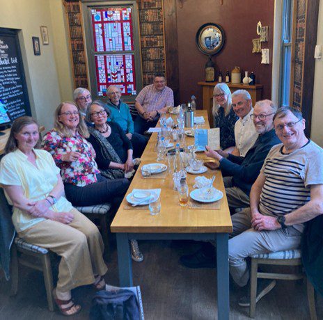
Over the course of the weekend, not only did we get plenty of fresh air and exercise, we discussed and learned a lot regarding the geology of the Ludlow and Bridgnorth areas. In addition, we enjoyed the spectacular scenery and the good camaraderie of colleagues making new friends which we hope to enjoy the company of on future trips. Our gratitude goes to Martin Whiteley for yet another engaging and excellently organised field trip with good weather thrown in.