
Report by Jane Allum and Stuart Burley. Attendance 3
On Saturday 27th June following liaison with the landowner, Rob Summers, Stuart Burley (WGCG), Jane Allum (WGCG) and Sam Macvie (Bryologist) met to explore the renowned exposure of the Arden Sandstone in Mows Hill Dingle, Warwickshire’s only natural waterfall.
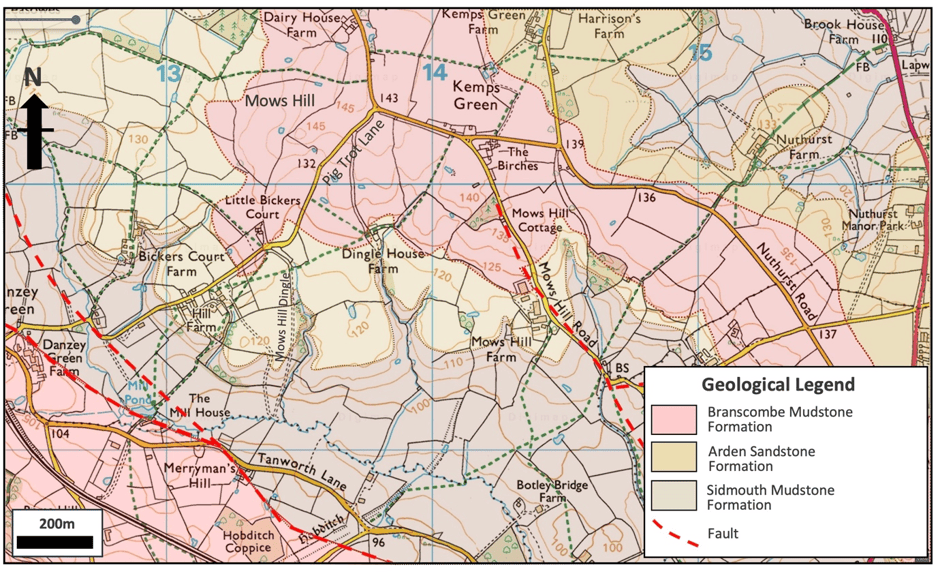
A ‘dingle’ is a medieval term for a steep sided, wooded valley or glade. This is entirely fitting for Mows Hill Dingle, which is a 15m deep, wooded gorge, formed as a glacial meltwater valley, cutting down into the Sidmouth Formation as the present day river flows across the Arden Sandstone. The waterfall is formed by the hard scarp of the Arden Sandstone.
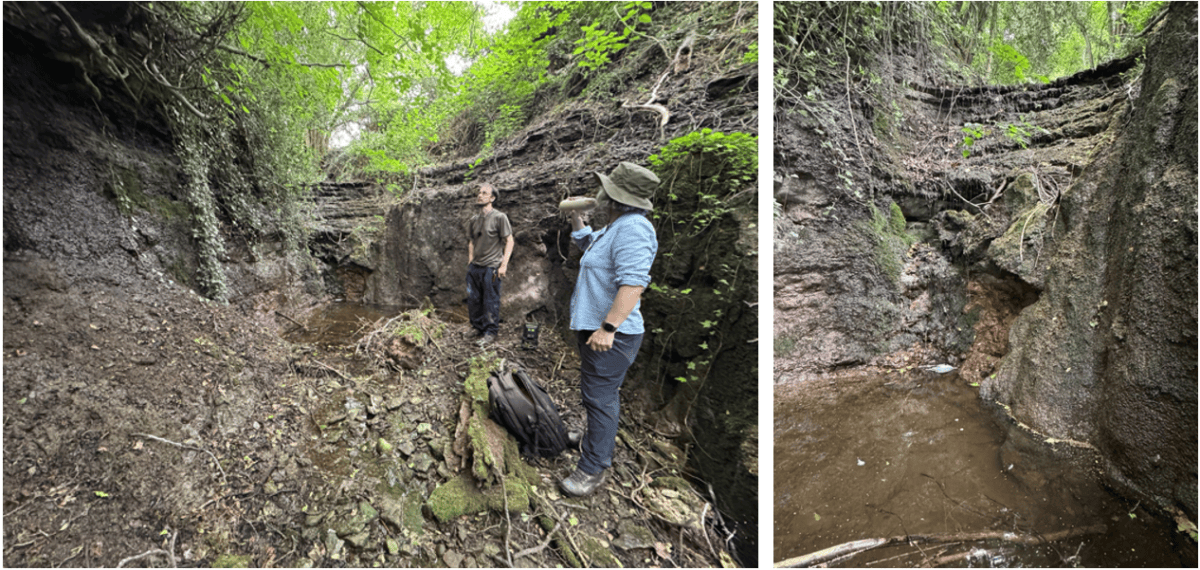
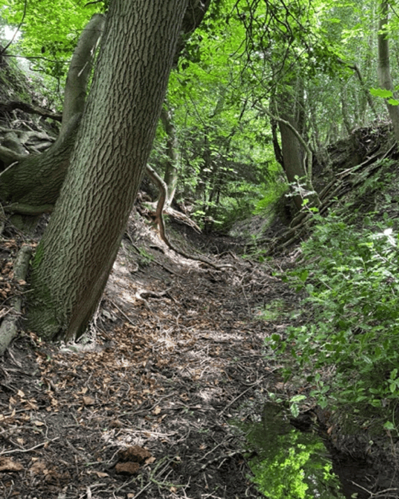
We were able to access the upper section of the dingle with relative ease via a style (NGR SP13475 69687) followed by a wooden bridge over the dingle stream. A gentle walk southwards in the stream on Arden Sandstone bedding planes took us to the top of the ~3m high waterfall where descent is not possible without ropes.
To access the lower section of the waterfall requires a steep descent into the dingle and a 30 minute walk north back towards the waterfall through dense undergrowth and fallen trees. A closer access was subsequently found at approx NGR SP13474 6955 via a cutting formed by a stream. This is a scramble and still not an easy access point.
The geology map in the area around the dingle shows two streams cutting through the gently dipping, almost horizontal Arden Sandstone Formation which forms the steep topographic slopes and dingle valleys. The overlying Branscombe Mudstone Formation caps the Arden Sandstone whilst the Sidmouth Mudstone Formation occupies the River Alne valley bottom. The streams cutting through the deep gorges were formed by glacial meltwater flowing from the ice sheets to the north where the present day watershed is located.
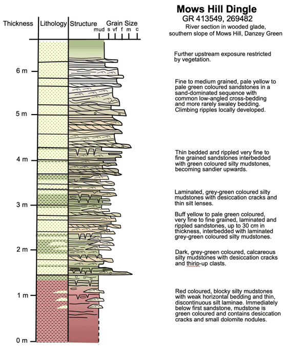
The waterfall provides a 4m section through the Arden Sandstone Formation which was logged in the summer of 2025. This reveals a 5m section of Arden Sandstone with a typical shoreface depositional environment, very similar to the section exposed along the Grand Union Canal at Shrewley.
The dingle still contained flowing water despite the early summer drought but the fallen trees and rotting vegetation in the bottom of the dingle along the lower access route and with the steep slopes make the walk up to the waterfall very difficult. This is a spectacular, beautiful location worthy of conservation and observation by WGCG, but the scale of the exposure and difficult access will make any geoconservation work challenging as well as time consuming . The unique waterfall and unspoilt wooded glade environment might make this a candidate location for a combined geological-biological SSSI – we will discuss with the Warwickshire Wildlife Trust to gauge their interest. Sam Mcvie will report back to us on the bryophyte population of the dingle, and the landowner is keen to see the dingle preserved, and potentially access made easier. Sam will advise what geoconservation would be acceptable here with regards to the mosses and lichens. We will continue to monitor and discuss with the landowner how access to the lower section could be improved.