
Report by Ray Pratt & Jane Allum. Attendance 21
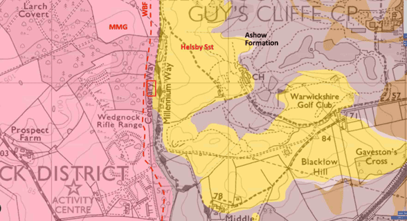
On Wednesday, August 5th, following geoconservation work by a small team of volunteers in February 2026 (Stuart Burley, Ray Pratt, Peter Hawkswood and Tom Collins) 21 members met at the Warwickshire Golf course and walked up to the exposure of the Helsby Sandstone (Middle Triassic) in Woodloes Quarry on a delightful, warm summer evening.
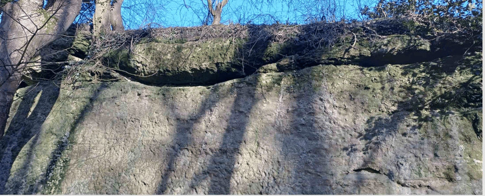
The Helsby Sandstone is a sandy, low sinuosity river deposit, and is well exposed in the quarry faces. It is a similar section to the sequence seen at Guys Cliffe, although has additional interesting features. The sandstone is fine-to medium-grained, cross-bedded and locally micaceous in the summer sun. The flow direction as determined by the cross-bedding foresets is quite variable and Stuart explained the apparent difference in flow direction with reference to existing rivers where anastomosing braided rivers develop. A channelised sandstone is present towards the top of the exposure overlying a distinct mudstone paleosol. A number of c. 2.0m long vertical calcified root traces, ‘rhizoliths’ are seen in the underlying sandstone.
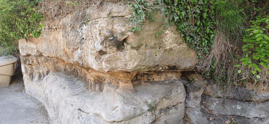
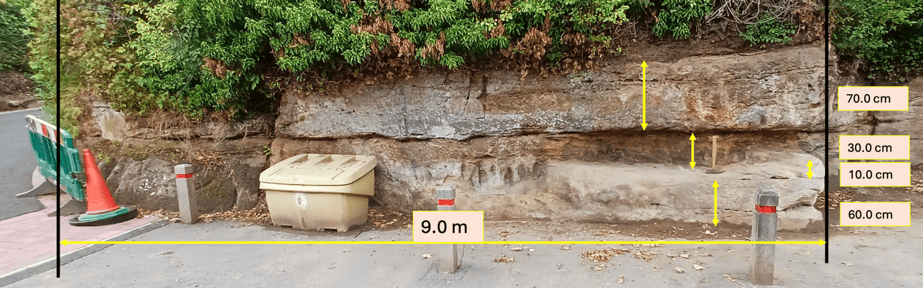
Our next stop was the exposure by Leek Wooton bus stop. Days prior to the visit, this rock face was mostly obscured by ivy and other vegetation. This was recently removed by WGCG volunteers especially for this event enabling the variable lithology and sedimentary features to be observed. This is an excellent exposure due to its ease of access and the variety of sedimentological features to be observed. As it is in the bus stop it is possible to very easily get up close to examine the rocks. The channelized nature of the sandstones are clear, and the basal erosion surface of two fluvial flow events can be seen, with about a metre of vertical relief on the erosion surface evident. Individual bed forms are around 1m in thickness giving a minimum water depth for the river channel, and reactivation surfaces demonstrate variation in flow discharge rates and water depth, indicating that the river was likely braided during water falling stage. In addition there is a small section where very well rounded grains are seen in a soft, friable sandstone lying on top of a calcrete (fossil soil), which is then overlain by another fluvial deposit. This may be a small wind-blown sand in the dried-up river course.
The calcrete layer (2 in the image below) extends around the Leek Wootton exposure, varying in thickness. Throughout there are very coarse grained, irregular shaped clasts of calcite which are rip up clasts reworked from an underlying calcrete bed.
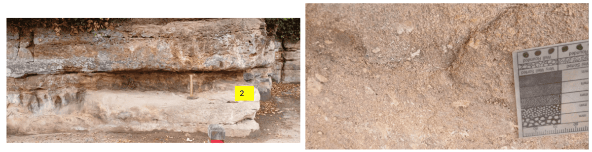
Sandstone 2 comprises a variably 10cm thick, very calcareous calcrete layer. It is light brown, firm-friable, very fine to very coarse, round to subangular frosted translucent quartz, poorly sorted, common white patchy calcareous cement, large fragments of yellow light brown calcite clasts –probable reworked rip up clasts from another calcrete bed, poor porosity. Overlying this calcrete layer is another soft, friable sandstone (3 in the image below), 30cm thick, with sub-round to sub-angular translucent quartz with traces of dark coloured grains.
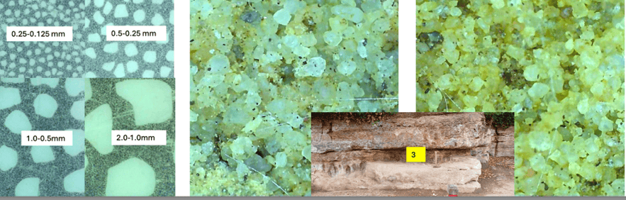
As the image above shows, whilst this sandstone does contain a lot of well-rounded grains it also contains many sub-angular grains and is not as well sorted as would be expected from an aeolian sandstone. It is probable that this bed contains a significant proportion of reworked aeolian sand deposited in a fluvial setting and due to the more rounded nature of some of the grains it is less resistant to erosion resulting in this inset eroded bed.
Aeolian units are not uncommon in the Helsby Sandstone, and have been described in outcrops from northern Cheshire, including the famous Frodsham Sandstone Member, which is interpreted as fossil wind blown draa sand-ridges. However, wind blown units have not previously been described from the Helsby Sandstone in Warwickshire, so this is a first sighting by WGCG.
The group retired to the pub for 8pm for refreshments and engaging conversation. One WGCG member, who was unable to join us for the field trip, did join the party at the pub
Thanks to Ray Pratt for organizing a very successful Summer Social and to the 2012 WGCG team of volunteers who initially cleared Woodloes Quarry.